Duration: 3:15
Road access: Village of Biot
Park your vehicle in a car park (Bâchettes, Fontanette).
Walk back to Paul Langevin School which is in front of Biot Town Hall on Route de Valbonne, D4.
Departure: at Paul Langevin School. Saint Eloi Square.
Circuit description from Paul Langevin School:
You are on the Place Saint-Eloi, at Panel 1 "Ecole Paul Langevin". Follow the direction "Brague Trail".
Get on "Chemin Joseph Durbec". After 200m, you'll arrive at Panel n °1 bis "Chemin Joseph Durbec".
Follow the direction "Chemin de Roquefort".
Leave "Chemin Joseph Durbec" on the right, taking the stairs that lead you to a small path leading to road D4. Cross immediately and turn left in order to go up 100m on road D4.
When in front of the chapel, turn right and take the "Chemin Saint-Julien" that you'll follow for 800m to get to Panel No. 55, "Chemin de Roquefort" (30 minutes). Follow the direction "Les Pierres à Four" on the right, on the "Chemin de Roquefort".
Go up Chemin de Roquefort to its end, on a pleasant little paved road, to join Panel No. 56, "Les Pierres à Four" (50mn). Follow the direction "Tamarins Bridge" on your left.
You arrive at a fork of tracks. Enter the one on the right protected by a metal barrier, then take the rightmost path that will go up and widen and lead you to a metal barrier that limits the subdivision of the "Monts d'Azur".
To the left of the barrier, enter a path. At a bifurcation of trails, turn left before reaching the fence that adjoins houses of the subdivision "Monts d'Azur".
Walk along the fence on the left and dive by a very uneven passage always along the fence. You'll get at the level of a metallic barrier of the end of the "Avenue des Mésanges". Follow "Avenue des Mésanges " to the crossroads with" Avenue des Hirondelles ". Then turn left into "Avenue des Hirondelles" which you'll follow down completely to reach the "Route de Valbonne" D4.
You arrive at Panel No. 57, "The Green Valley", (1h40). Follow the direction "Pont des Tamarins".
Cross immediately and turn left towards Biot and stay on the right-hand side of the road.
Just before the first house you meet, take a path that follows the fence of a villa facing south.
After the descent, it bends towards East and rejoins the paved road "Avenue des Fauvettes", which you'll take on the left.
You will soon turn right into "Route de l'Agasse", which after a short climb allows you to go down to the Tamarins Bridge.
Before arriving at the bridge, you must leave the "Route de l'Agasse" for a path on the right which allows you to go down faster.
This path splits again. Always take the sharpest branch on the right. You arrive at Panel No. 5, "Tamarins Bridge" (1h55).
Follow the direction "Biot".
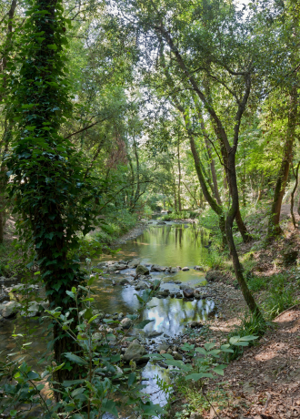
Pass on the bridge on your right and take immediately to the left the path of Brague, direction Biot. After 10 minutes, you will pass on the iron bridge of the confluence with Bouillide River.
Continue Brague Trail to Panel No. 4, "Gué des Clausonnes", (2h05). Follow the direction "Biot".
Cross the Ford and continue the Brague Trail on the left bank to reach Panel No. 3, "La Rine", (2h40).
Follow the direction "Biot".
The trail continues along the river, then rises to dominate the riverbed and finally go up by steps up to Panel # 2, "Les Fournaises", (3h).
Follow the direction "Biot".
You're then on "Chemin Joseph Durbec". Continue this tarmac path to completion. You pass Panel n ° 1bis, "Chemin Joseph Durbec".
Continue and finish Chemin Joseph Durbec, and soon you'll get back to your starting point at Panel No. 1, "Paul Langevin School", (3:15).
Rates
Free access.
Hours
All year round.
Further information
- Individual tours : Unguided individual tours available permanently
- Services : Pets welcome
- Distance : 11 km
- Type of circuit : BOUCLE
- Signposted : Yes
Services
- Pets allowed